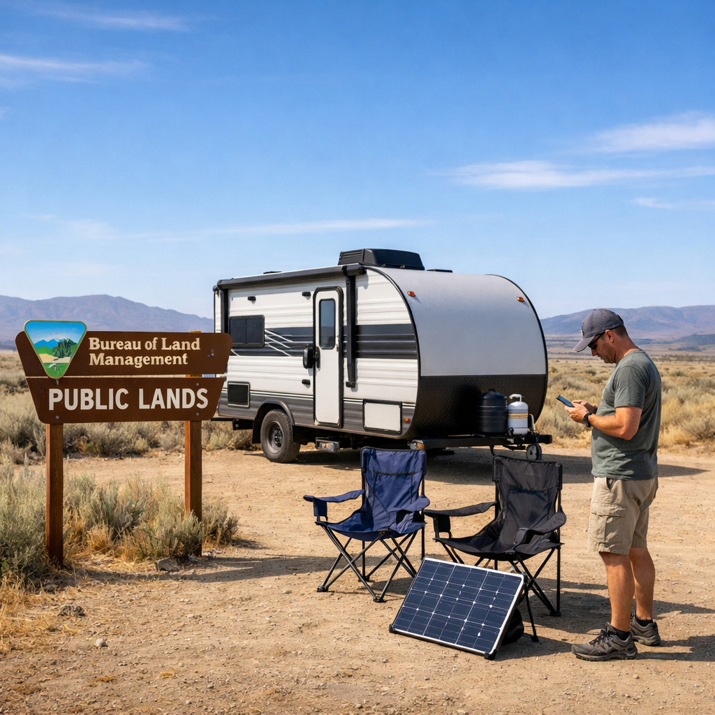
How to Find Safe, Legal Boondocking Spots on Public Lands
Boondocking—also called dispersed camping—lets you stay off-grid on public lands for free or very low cost. The key to doing it safely and legally is verifying land ownership and access, following local rules, and arriving self-sufficient for water, power, and waste. This RV Critic guide shows you how to choose the right public land, confirm legality with authoritative maps, and plan your resources so you can enjoy a quiet, compliant stay without surprises.
What boondocking means and where it’s legal
Boondocking is camping without hookups or facilities on public or private land, so you must bring your own water, power, and waste solutions. Think of it as “self-contained camping” that trades amenities for solitude and flexibility off the grid [Boondocking basics overview].
“Is boondocking legal?” In many areas, yes—especially on Bureau of Land Management (BLM) and National Forest lands—within posted limits and local orders. Most areas have stay limits and site-placement rules you must check and follow.
Dispersed camping: Camping outside developed campgrounds, typically without amenities, on lands managed by agencies like the BLM and U.S. Forest Service. You must be fully self-sufficient with water, power, and waste. Rules, stay limits, and access vary by unit—always verify before you go.
BLM publishes official guidance explaining where and how to camp on its lands, including stay limits and local contact info.
Source: Boondocking basics overview from Four Wheel Campers (dispersed vs. developed, self-sufficiency) fourwheelcampers.com.
Start with the right public lands
The best first stops are BLM districts, National Forests, and state trust lands that clearly permit dispersed camping. State trust policies vary—some states allow dispersed camping, others don’t—so check each state’s DNR/forestry page before you plan.
Expect crowds near national parks and popular attractions. Adjacent public lands can be busy and picked over at peak times, so plan to scout deeper down legal forest roads and arrive early on weekends. For beginners, look for regions with plentiful graded dirt or gravel access roads and wide turnouts—high-desert BLM areas in Arizona and Nevada, plateau forests in Utah and New Mexico, or pine flats in eastern Oregon and northern Michigan are good starting points. When in doubt, call the local ranger station for current conditions, closures, and best-access advice.
Verify land ownership and access
Use a simple, repeatable process before you roll your rig down any dirt road. RV Critic recommends verifying boundaries, private parcels, and legal road status in this order.
Turn on public-land overlays
In OnX Offroad or Gaia GPS, add public land overlays to see BLM, National Forest, and other designations. Gaia’s free Gaia Topo layer shades public parcels so you can quickly spot legal areas.Confirm it’s not private
Cross-check parcels with a property-map tool like Regrid (about 25 free lookups a day) to ensure you’re not crossing or camping on private land. Note easements and check gates.Verify legal vehicle routes (MVUM)
For National Forests, consult the Motor Vehicle Use Map to confirm drivable roads, seasonal openings, and where roadside dispersed camping is allowed.
MVUM (Motor Vehicle Use Map): The U.S. Forest Service’s official, legal record of where motorized travel is allowed and when. It shows open roads and trails by season, vehicle type, and often identifies where dispersed camping is permitted along road corridors. If it’s not on the MVUM, it isn’t legal to drive there.
If signage on the ground says “Area Closed,” “No Motor Vehicles,” or “No Trespassing,” obey it—even if a crowd-sourced app or an old map suggests otherwise. Sources: guidance on public land overlays and on-the-ground signage caution from Alpine Savvy’s mapping tools guide alpinesavvy.com.
For MVUM and corridor rules, check forest/unit pages and their orders. A detailed overview of typical USFS/BLM rules is summarized in Black Series’ dispersed camping guide blackseries.net.
Confirm local rules, limits, and fire restrictions
Across much of BLM and National Forest land, dispersed camping is limited to around 14 days within a 28‑day period—but specific limits and rotation rules vary by field office or forest. Always check the local unit page and current orders before you go (BLM’s camping pages centralize official guidance and contacts) blm.gov.
Placement norms to expect:
- Keep your campsite 100–200 feet from water sources (some forests, like Olympic, require 200 feet).
- Motorized use for dispersed camping is often limited to within 150 feet of designated routes; verify corridor distances on the MVUM and in current forest orders.
Check current fire restrictions and any emergency closures on the local unit page, and carry an approved fire pan or shovel if required. Source for common distances and corridor rules: Black Series’ USFS/BLM guide blackseries.net.
Scout sites with maps, apps, and ranger intel
Layer official sources with crowd reports, then confirm with current orders. RV Critic suggests starting with official sources, then layering user reports—always verifying with current orders.
Official sources
- BLM unit pages for stay limits, closures, and dispersed guidelines.
- USFS MVUMs for legal roads and roadside camping corridors.
- The USFS Visitor Map app for roads, gates, and closures; it’s useful when MVUM PDFs are hard to read on a phone lorjorexplore.com.
Crowdsourced tools
- iOverlander for free/low-cost spots and overnight parking possibilities (Walmarts, rest areas).
- Campendium and similar apps for user photos, road-condition notes, and cell reports. Cross-reference pins with official maps and current orders because crowd data can be outdated feliciafullwood.com.
Mapping aids
- CalTopo’s Land Management overlay to visualize ownership, plus satellite imagery to spot existing clearings and turnarounds.
Tip: Download offline areas and layers for all the regions you’ll pass through before leaving Wi‑Fi, and save PDFs of MVUMs for each forest district.
Validate access and safety before you roll
- Use a trail-mapping app like OnX Offroad to check public land boundaries, road classifications, and difficulty ratings so your rig isn’t surprised by ruts or washouts.
- Preview approach roads and likely turnarounds with satellite view or Google Street View where available. Check carrier coverage maps and planning overlays (e.g., FreeRoam). If you rely on satellite internet like Starlink, you’ll need a clear sky view and careful dish placement. See these planning tips in Lor/Jor Explore’s boondocking guide lorjorexplore.com.
- Review weather, fire danger, and seasonal closures via the local forest/BLM pages and state fire portals before committing to a remote road.
RV Critic’s pre-trip checklist keeps these safety and access checks in one place.
Pre-trip checklist:
- Tires in good condition (including spare), jack, and basic recovery gear
- Full fuel and extra water; arrive with daylight to scout
- Downloaded offline maps and MVUMs; paper map as backup
- Confirmed cell/satellite connectivity plan (or leave an itinerary with a contact)
- Exit plan if roads worsen or sites are full
Arrive, assess, and set up responsibly
Choose an already-established site on durable ground—don’t create new clearings. Park only where legal, stay out of meadows and riparian areas, and avoid soft soils after rain. Keep camp 100–200 feet from water where required and keep vehicles within posted limits (often 150 feet of designated routes).
Quick setup checklist:
- Confirm turning radius and a safe turnaround before committing
- Check for level ground and overhead clearance (trees, lines)
- Assess wind exposure and anchor awnings
- Verify fire restrictions; use existing fire rings or skip the fire
- Pack out all trash; secure food and control pets
Backup plans for private land and no‑go scenarios
- Private-host networks: Boondockers Welcome offers 3,000+ host locations at homes and small properties; Harvest Hosts connects you with wineries, farms, and attractions (membership and purchases often required). These are reliable, legal options when public land is full or closed boondockerswelcome.com.
- Parking-lot last resorts: Politely ask the manager after patronizing the business. Follow posted rules and local ordinances. Keep it low-key and leave before business hours.
- If the ground is posted “closed” or “no trespassing,” leave immediately—don’t argue with a sign or a landowner, even if an app pin disagrees.
Practical planning for water, power, and waste
No hookups means you arrive sized for your stay. Estimate daily use, bring redundancy, and know your dump/fill options along your route.
Compact-systems checklist:
- Water: Calculate daily gallons; carry extra jugs and a collapsible container; pre-identify fill/dump stations.
- Power: Solar plus a battery monitor covers most needs; conserve with LED lighting and smart charging; use a quiet generator only where allowed and observe quiet hours.
- Waste: Treat tank sensors as rough guides; never dump on the ground; pack out all trash and micro-litter.
Resource planning snapshot (typical conservation assumptions):
| Trip length | Party size | Water (gal) | Battery (Ah) | Trash volume |
|---|---|---|---|---|
| 3 days | Couple (2) | 12–24 | 90–150 | 1–2 kitchen bags |
| 3 days | Family (4) | 30–45 | 150–250 | 2–3 kitchen bags |
| 7 days | Couple (2) | 30–56 | 210–350 | 3–4 kitchen bags |
| 7 days | Family (4) | 70–100 | 350–550 | 5–7 kitchen bags |
Adjust for climate (hot = more water), devices (work laptops), and cooking style. If you’re new to off-grid planning, our starter checklist can help you right-size your systems before long trips: see RV Critic’s guide to avoiding common new-RVer mistakes (e.g., underestimating water and power) RV Critic: Mistakes New RVers Make.
Leave No Trace and campsite etiquette
Leave No Trace means minimizing your impact: plan ahead, camp on durable surfaces, dispose of waste properly, respect wildlife, and be considerate of others. Pack out all trash, avoid fragile sites, and minimize campfire impacts.
Do’s and don’ts:
- Do follow fire restrictions and drown cold ashes
- Do keep noise down and generators brief; observe quiet hours
- Do control pets and yield on narrow roads
- Don’t block roads, gates, or spurs; leave room for others to turn around
- Don’t leave property unattended beyond allowed windows (BLM generally limits unattended personal property to 10 days—12 months in Alaska)
Common mistakes to avoid
- Trusting a single app pin without verifying MVUMs and current forest/BLM orders
- Camping too close to water or driving off-road beyond legal limits (e.g., 100–200 feet from water; vehicles often limited to within 150 feet of designated routes)
- Forgetting to download offline maps or plan connectivity (Starlink needs a clear sky view)
- Ignoring “closed/no trespassing” signs even if digital maps disagree
- Overstaying the 14‑day-in‑28 window without checking local variations
For more trip-saving tips, see RV Critic’s quick-start checklist for new full-timers RV Critic: Full‑Time RV Living Checklist for Beginners.
Frequently asked questions
How do I verify a spot is legal before I camp?
Confirm you’re on public land via overlays, then use the MVUM or agency maps to ensure legal road access and roadside camping; RV Critic’s quick checklists help you double-check.
How long can I stay on BLM or National Forest land?
Many units use a 14‑days‑in‑28 rule, but limits vary by forest or field office. Check the specific unit’s website and current orders; RV Critic’s checklists remind you to verify both.
What distances should I keep from water, roads, and trails?
Stay at least 100 feet from water (some forests require 200 feet) and honor vehicle setback limits from designated routes, often 150 feet. Always follow the unit’s posted rules; RV Critic summarizes typical setbacks for quick reference.
What should I check before arriving at a boondocking area?
Download offline maps, confirm road conditions and weather, and arrive in daylight using RV Critic’s pre-trip checklist. Preview approach roads with satellite/Street View and verify your cell or satellite internet needs.
When should I choose a paid campground instead?
Choose a paid site during severe weather, if access roads are risky, or when you need hookups, dump stations, or reliable connectivity—or when nearby public lands are crowded or under fire restrictions. RV Critic offers planning checklists to help you decide.